
India-UN Map Row Explained: MEA Seeks Accurate Depiction of J&K and Ladakh
A new discussion of diplomacy has come up between India and the United Nations as regards the representation of Jammu and Kashmir and Ladakh in world maps. This has happened because India voted for a United Nations General Assembly resolution to promote the use of equal-area world map projections despite the fact that it clearly made it known that its approval does not mean it accepts any particular map of national boundaries.
As far as the Ministry of External Affairs (MEA) is concerned, it has stated that the sovereign territory of India, including the Union Territories of Jammu and Kashmir and Ladakh, has to be depicted in conformity with the Indian map. Inaccurate depictions have been termed unacceptable by the MEA as India’s position of sovereignty and territorial integrity “remains clear, consistent and non-negotiable.”
What Is the UN Map Resolution?
The issue originates from the adoption of UN General Assembly Resolution “Correct the Map: Rebalancing Global Cartographic Representation and Promotion of Equitable Representation of the World’s Regions, Especially Africa” on September 4th. This resolution was passed by 164 votes in favour, with six abstentions and one country – United States – opposing it.
Resolution deals mostly with the representation of continents’ sizes on the most popular maps. It calls for increased use of equal-area projections, which try to reflect the real proportions of land masses much better than, for instance, Mercator projection.
It should be noted that the resolution does not legally adopt any specific world map or resolve any territorial disputes. MEA explicitly stated that it neither adopts nor endorses any particular map projection nor addresses issues of political cartography, international boundaries, disputed territories or place names.
Why Did India Support the Resolution?
India’s position was more concerned with the general idea of enhancing the quality of representation on the world’s maps.
Mercator projection, which has been in use since several centuries ago, was designed specifically for navigational purposes. One of the most noticeable problems of Mercator projection is that it greatly distorts the size of the landmass as it becomes further from the equator. This results in an enlarged representation of landmasses such as Greenland and northern territories.
The new idea of equal areas projection aims at correcting this problem and providing a more true-to-life representation of landmasses according to their actual size on Earth. India agreed with this approach while clearly stating that this does not imply endorsement of a certain map and its representation of borders.
Where Do J&K and Ladakh Enter the Picture?
The matter became a delicate one since India is of the opinion that the maps that are used across the globe should mirror the exact geographical representation of their country.
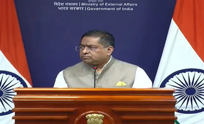
A MEA spokesperson, Randhir Jaiswal explained that the territory of India inclusive of the Union Territory of Jammu & Kashmir and Union Territory of Ladakh should be presented as per India’s official map. In addition, he emphasized that any form of misrepresentation would not be acceptable.
The clarification is necessary since map projections are not just technical aspects especially when it comes to territories which may be subject to political and diplomatic disputes. Therefore, India had dissociated itself from the idea that it was giving its consent to any particular visual aspect of how it represents its territory.
Would UN resolution have any effect on India’s position on Kashmir?
Absolutely not since India clearly pointed out that its vote does not in any way change its position regarding Jammu and Kashmir as well as Ladakh.
The MEA made it clear that the resolution had nothing to do with political boundaries or disputed territories. In essence, it is concerned with cartographic representation of the world landmasses.
Why Is the Issue Politically Sensitive?
Maps can have political implications since boundaries represent how the territory is viewed and visualised. This is especially so in relation to Jammu and Kashmir and Ladakh, since there is disagreement between India and Pakistan about their territory.
New Delhi therefore considers it important to make sure that maps reflect their territorial claims as part of sovereignty and territorial integrity.
This is why the MEA reacted despite the UN resolution having nothing to do with settling territorial disputes but simply addressing equal-area cartography.
What Is the “Equal Earth” Projection?
The Equal Earth projection was created in 2018 as an equal-area world map projection. While unlike Mercator, its main aim is to preserve the relative area of the landmasses as well as keeping recognisable shapes.
The African Union has been behind the adoption of equal-area projection because conventional maps can underestimate the size of Africa. In similar fashion, the UN resolution has been adopted to ensure that more balanced approaches are encouraged in fields like education and public relations among others.
However, India does not consider that adopting the equal-area projection automatically means accepting the Equal Earth projection or any particular map.
What Does India Want?
“India’s stand can thus be summed up in one statement – that there needs to be a difference between the projection of a map and the representation of the territory.” New Delhi welcomes any efforts towards reducing the distortion in the relative sizes of continents, but at the same time desires that the map which is presented in an international forum represents the territory of India as depicted by its own official map.
Why This Matters Beyond the Map
At first sight, the conflict might seem to be just a technical one relating to maps. But what it does is demonstrate how maps and diplomacy might overlap with each other.
In case of India, the debate serves as a chance for it to reiterate its stance on Jammu and Kashmir and Ladakh in addition to the overall aim of bettering geography around the world.
What the event demonstrates is how even a solution centered around map projections might cause diplomatic tensions if those maps include disputed territories.
Conclusion
Thus, the debate on India’s objections to the new India-UN map is more concerned with making sure that the cartographic revolution doesn’t result in the confusion of geographical depiction and political demarcation.
India approved of the UN resolution calling for an equal area map but clarified its standpoint on Jammu & Kashmir and Ladakh: their depiction must match the official map of India.
Hence, the MEA’s statement is rather clear. India is in favor of improved and proportional cartography in the world but doesn’t see the latter as a way of endorsing the map or altering its standpoint on sovereignty.
India has been advocating the cause of better maps of the world within the UN but is adamant in its standpoint that the cartographic revolution shouldn’t affect India’s standpoint on J&K, Ladakh or territorial sovereignty.
What’s shaping India, AI and West Asia today?
Could Agentic AI Transform Youth Skills?
Check out how MeitY and Intel are bringing no-code AI automation training to Indian youth.
Can Voice AI Transform Public Services?
Find out how Karnataka is testing Voice AI for healthcare and citizen services.
Why Is Strait Tension Rising Now?
Uncover why US naval presence and Iran’s claims are escalating Hormuz tensions.
What Is India Demanding at UNSC?
Browse India’s urgent call for West Asia de-escalation amid Strait of Hormuz attacks.
Is Youth Unemployment India’s Bigger Crisis?
Track down the deeper employment challenges behind Dharmendra Pradhan’s resignation.