
Survey of India Maps 27 Arunachal Border Locations: Names, Significance and Key Details
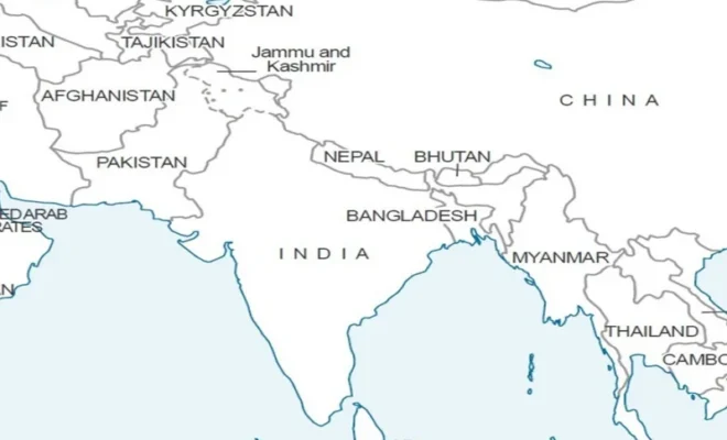
The Government of India has named 27 locations and geographical features in Arunachal Pradesh in accordance with Indian names on the survey maps prepared by the Survey of India. This naming has been done after consultations with the government of Arunachal Pradesh.
This is important since Arunachal Pradesh is a region of territorial disputes between China and India. China has always tried to name geographical features of this state by using Chinese names and India has opposed such nomenclature. Therefore, the current naming process is important from a cartographic and strategic point of view as well.
What Has the Survey of India Mapped?
The 27 named geographical features include 21 land areas, four mountain passes, one lake and one monument. According to the official list, there are places all over Arunachal Pradesh that have historical or strategic significance due to their location near to the India-China border or involvement in military operations.
Four mountain passes that have been named include Dzo La, Riza La, Pukur La and Thag La. The lake included in the list is Sambho Sarovar while Sher-e-Thapa Memorial is the monument on the list. Rest of the 27 features have been categorized as land areas.
Full List of the 27 Locations
Longju, Maja, Bisa, Dzo La, Riza La, Pukur La, Thag La, Sambho Sarovar, Bara Kundun, Chhota Kundun, Dhan Bari, Pritnagar, Buddhamandir, Jairampur, Teritnagar, Ramnagar, Jaswant Garh, Sagar, Padma, Jyotinagar, Baisakhi, Sher-e-Thapa Memorial, Chhota Ropuk, Bara Ropuk, Shivaji Nagar, Sunpura and Kamlang Nagar are mentioned in the official Survey of India List.
They are all formally listed in the Survey of India map of Arunachal Pradesh for cartographic purposes.
Why Longju Has Historical Significance
Of all the locations mentioned, Longju has special historical significance. It relates to one of the earlier India-China border issues in 1959, long before the India-China war of 1962. According to reports, Longju is one of the strategic border points in Upper Subansiri district.
Therefore, this listing is not only an effort to add another place name in a geographical map. Longju itself is historically significant in the context of the India-China border issue.
Why Thag La Matters
The pass of Thag La is yet another significant site in the list. It is linked with the initial stages of the India-China conflict of 1962 and lies in the Tawang district of Arunachal Pradesh.
This region is always of strategic significance due to its location on the eastern Himalayan frontier. So, its inclusion in the revised map brings to light once again a place which was part of a very significant event in Indian military history after independence.
Four Mountain Passes
These mountain passes include Dzo La, Riza La, Pukur La, and Thag La. Out of these, three passes namely, Dzo La, Riza La, and Pukur La have been reported to be in Upper Subansiri near the McMahon Line.
Mountain passes have a special significance in the state of Arunachal Pradesh as the terrain of the Himalayas has a direct impact on the border movement. It also gives a standardized name to these mountain passes in India’s official map.
What Is Sambho Sarovar?
Sambho Sarovar is the only lake among the 27 places and features which have been marked out for inclusion in this exercise. Sambho Sarovar is characterized as a high altitude lake in Arunachal Pradesh.
The inclusion of natural features such as lakes and passes indicates that the exercise is not merely confined to the marking out of settlements but it is an effort to establish a standardized map record of geographical/historical features.
Who Is Honored with the Sher-e-Thapa Memorial?
Sher-e-Thapa Memorial is the only monument among the 27 places which are being mapped. It is dedicated to Trilok Singh Thapa who was a soldier connected with the 1962 war and has distinguished himself in the defence of the area.
Why India Has Made This Move Now
It is significant when it comes to the timing of the survey. In addition to the announcement, there is the ongoing renaming attempt by China of the locations within the disputed areas in Arunachal Pradesh. The Chinese have called Arunachal Pradesh by the name of “Zangnan” or “South Tibet”. This name is strongly rejected by the Indian government.
As for India, it has repeatedly stated that Arunachal Pradesh is a fundamental and inseparable part of the territory. Thus, its inclusion in Survey of India maps confirms the Indian official geographic terminology and official position.
In addition, the Ministry of Home Affairs has provided the reason behind this move. According to it, the primary purpose of such a step was the improvement of the knowledge and understanding of the locations among the people.
Is It a New Border of India?
Here it should be stressed that the very announcement does not provide any new demarcation of the India-China border.
The government just officially identified and standardized the names of locations and features of Arunachal Pradesh which have already been shown on Indian official maps. Thus, it can be considered a cartographic move more.
Why Official Maps Matter
Official maps provide consistency of geographical references useful for governmental administration and awareness purposes.
Through providing Indian names in the Survey of India maps, the government of India establishes the Indian reference for these places. This is especially so when it comes to the border disputes where the use of different geographical terms is part of the wider political discourse.
The updated Arunachal Pradesh map is now available in the Survey of India website of state-maps.
Implications of This Event to the India-China Dispute Over the Region
The 27 locations renaming initiative should, therefore, be seen as part of a bigger discourse on geographical terms and the narratives attached to them.
In the case of India, it serves to consolidate the position on Arunachal Pradesh. The China on the other hand had been conducting similar naming initiatives as part of its larger stand on the region. India has declined such positions and their geographical terms.
The current Survey of India initiative is yet another step towards this ongoing debate.
Conclusion
The Survey of India’s identification of 27 Arunachal Pradesh locations is more than a routine cartographic update. The list brings together historically significant border locations such as Longju and Thag La, strategically important mountain passes, a high-altitude lake and a military memorial.
While the government says the immediate objective is accurate recognition and greater public awareness, the timing also gives the exercise wider significance amid India’s continuing territorial disagreement with China.
For India, the updated map provides a standardized official record of these locations and reinforces the country’s established position on Arunachal Pradesh.
India, Travel, Tech & More to Explore
Why Is India Seeking Accurate UN Maps?
Check out why India has raised concerns over J&K and Ladakh depictions.
What Makes Pixel 11 Pro Stand Out?
Find out about its camera, AI features, pricing, and India availability.
How Can You Book IPL Final Tickets?
Uncover the steps, prices, and stadium stand details for IPL 2026.
Could India-China Border Trade Restart?
Explore how Nathu La, Shipki La, and Lipulekh Passes are reopening.
Where Can You Stargaze Under Stars?
Browse India’s best offbeat camping destinations for memorable stargazing experiences.