
Western Ghats Landslide Preparedness: Early Warning Sensors Deployed in Vulnerable Hill Districts
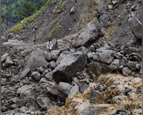
The Western Ghats are once again approaching yet another important monsoon season when authorities and experts are focusing more attention on landslide preparedness, real-time landslide monitoring and early-warning systems in vulnerable hill districts.
It is especially necessary in regions of Kerala and Karnataka, where topographic factors such as steep slope gradients, high intensity rainfall, weathering and change in land-use practices may all lead to slope instability. There have been recent studies identifying vulnerable districts like Uttara Kannada, Chikkamagaluru and Kodagu in the Western Ghats of Karnataka.
While older systems used rainfall warnings alone, new techniques now involve using rainfall data along with information from ground sensors, satellite imagery, soil condition and slope motion data. The idea is straightforward – provide early warnings in order to allow time for the authorities to take action.
Why the Western Ghats Are So Vulnerable
The Western Ghats run through various Indian states on the western side of the country and comprise hills, areas with vulnerable geology, and regions with very heavy monsoon rains.
The states of Kerala and Karnataka face risks of frequent landslides. According to one 2026 study conducted in six districts of Karnataka in the Western Ghats, the highest percentage of highly susceptible zones was found in Chikkamagaluru, Kodagu, and Uttara Kannada.
However, rainfall does not cause the risk alone. Activities related to changes in land use, hill cutting, road building, etc., may affect the slope stability as well. In addition, another 2026 study showed that the susceptibility of Karnataka’s Western Ghats to landslides might be increasing under future conditions of rainfall and land use and emphasized the need for early warning prioritization in such districts as Uttara Kannada, Chikkamagaluru, and Kodagu.
How Early-Warning Sensors Can Detect Landslide Risk
Modern landslide early warning systems are created to monitor changes that may happen prior to the appearance of the visible ground failure.
Such sensors are able to track various aspects, including soil moisture, rainfall, ground movements, and underground conditions. Some modern early warning systems use sensors installed under the ground surface to track changes inside a slope which are not visible just by observing its surface.
The research related to a real-time monitoring system implemented in Kerala shows how a low-power network, like LoRaWAN, is used to communicate with multiple sensors and gather information from tough environments. This monitoring system integrates environmental and movement data and uses machine learning algorithms to improve the detection and warning.
This approach is important because a landslide can start without any visible ground crack and small changes in soil moisture, pore-water pressure, and ground movement are an important indicator of increasing instability.
Kerala Is Expanding Local-Level Monitoring
Kerala is currently making efforts in developing more localized landslides early warning systems. Kerala State Disaster Management Authority has identified one project for Landslide Early Warning System in 2026, for the area of Madisserimala in Kanichar panchayat of Kannur. It also identifies one more project for a district-level disaster risk monitoring system in Wayanad.
One project identified in Kannur deserves special mention since it is designed to give up to 24 hours of advance notice on landslides by using combination of local monitoring as well as forecasting of rain. The project will involve KSDMA, K-DISC and CSIR-Central Building Research Institute. Sensors would be set at various depths and locations on the hill which is at risk.
The objective of these systems is not to forecast all landslides with certainty. Instead they are supposed to detect situations where the pre-defined warning levels are crossed.
Wayanad and Idukki Remain Important Monitoring Zones
Wayanad and Idukki are some of the districts of Kerala that have been identified specifically due to their vulnerability to landslides and hilly terrains.
As far as the landslides warning system of India is concerned, the two districts of Wayanad and Idukki have already been involved in such an initiative on the experimental and operational level. Government sources have provided information about cooperation between various agencies including the Geological Survey of India, India Meteorological Department, National Remote Sensing Centre and State disaster management authorities in integration of rainfall forecast, landslides susceptibility and other data.
This would be the first step towards a detailed warning system that could aid local decision-making in future.
Karnataka Is Using Data to Identify the Most Vulnerable Slopes
The Western Ghats of Karnataka are also attracting more and more researchers and disaster management practitioners’ interest.
A 2026 study of the six districts of the Western Ghats employed machine learning modeling to generate detailed landslide susceptibility maps. The study concluded that Chikkamagaluru, Kodagu and Uttara Kannada had particularly high proportion of highly susceptible landslides, while Dakshina Kannada, Shivamogga and Udupi had low proportion of very susceptible areas.
An Ankola landslide study conducted in the Utara Kannada district found that rainfalls and human activities had played an important role in causing the landslide, and suggested pore-water pressure as a promising parameter in early warning techniques.
Such studies can assist in identifying the places that need monitoring and not considering all hill slopes as being equally dangerous.
Satellites Are Becoming Part of the Warning Network
Ground sensors are just one component of India’s emerging landslide monitoring framework.
Satellite Integrated Landslide Assessment and Alert System (SILAAS), an innovation by the Indian Space Research Organization (ISRO), uses satellite images and rainfall data and integrates other geospatial data such as topography to facilitate landslide monitoring and early warning. The system has been created to generate useful information for disaster management agencies.
Additionally, the Landslide Atlas by ISRO has mapped around 80,000 landslides in vulnerable areas of India, including Western Ghats, based on satellite and aerial data for the period of 1998 to 2022.
Both satellite observation and ground sensors can work in tandem to gain a comprehensive view of events unfolding on vulnerable slopes.
What an Early Warning Actually Means
An alert does not mean that the landslide is inevitable.
It means that the monitored parameters have exceeded those where there would be an increased chance of landslides. Thus, the authorities may combine the knowledge gained with predictions regarding the rainfall, observations, and the state of roads to make decisions about actions to be taken.
The response may range from limiting access to hazardous roads, evacuation from a slope, to increasing the number of patrols or even preparing an emergency team.
This is essential since landslides are natural disasters and no matter how efficient a monitoring system is, there may always be a problem with prediction accuracy.
Why Sensors Alone Cannot Prevent a Disaster
Technology may offer an early warning signal, but this information will prove to be of any value only if it reaches people promptly and prompts action on their part.
For that reason, local administrators require plans for evacuations, effective communication systems, trained emergency teams, and populations that know what various levels of warnings imply.
Thus, the national strategy aims at the integration of ground sensors and IoT devices with overall landslide forecasting and decision support systems. The government’s disaster management plan has, in particular, emphasized the integration of ground sensors and IoT devices into the national landslide forecasting system.
What Residents in Vulnerable Areas Should Watch For
Those people who reside around steep slopes must take the official warning regarding rainfall and landslides very seriously especially during times of excessive rains.
Cracks forming on the slope or buildings, abnormal behavior of retaining walls, alterations in drainage, tilting of trees or poles, as well as seepages or mud formation are some of the factors which could prompt one to contact the local authorities. One should not enter places which the authorities have deemed dangerous and obeying instructions to evacuate before actual slope failures.
The most appropriate thing to do in such situations is always taking the official warning from the district disaster management authorities regarding the stability of the slopes.
Conclusion
The spread of landslide early-warning technology in the Western Ghats marks an important transition from a disaster response approach to disaster preparedness through recognizing risks before they materialize.
From underground sensors and rainfall measurement to machine learning and remote satellite mapping, India is creating several levels of landslide surveillance technology. The local projects in Kerala and the susceptibility analysis in Karnataka reveal how close this technology is getting to the vulnerable communities.
However, the current issue is the successful implementation of scientific early warning and turning it into practical measures. While sensors can identify a change in the situation, what really matters is how well people organize the evacuation process.
The Western Ghats can never be made landslide-proof, but better sensors and satellite monitoring will allow them to have more time to act when extreme rainfall occurs.
Catch Up on Today’s Key Stories
Where Can You Escape This Monsoon?
Check out the best Western Ghats getaways near Mumbai and Bengaluru.
Why Is Kerala Facing Heavy Rain?
Find out how cyclonic circulation is triggering widespread rainfall across Kerala.
Will Pakistan’s Airspace Ban Continue Longer?
Track down the latest extension affecting Indian commercial aircraft until September 24.
What Did India Tell The UN?
Uncover India’s latest support for Palestine and the two-state solution.
Why Is Snakebite Reporting Now Mandatory?
Go through Maharashtra’s new hospital reporting rules for snakebite cases.